A first example: the VHF coverage of my QTH
1. Acquire elevation database from the internet
You have Radio Mobile installed...
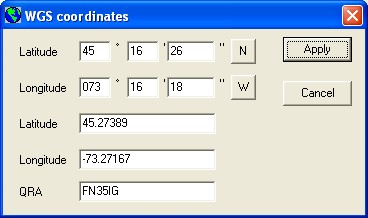
My QTH is St-Jean-sur-Richelieu
Latitude 45° 16' - Longitude 73° 16'
You can use the following elevation data files for my area: srtm1.zip
Decompress them in the following directories (Dont forget to use folder names):Elevation database is now ready for Radio Mobile!
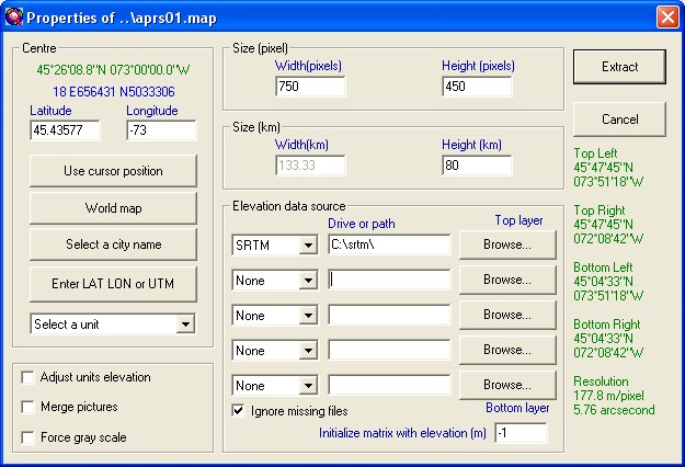
2. Extract elevation data and create a map picture
Launch Radio Mobile program. In "Files" menu, select "Map Properties", and enter the following values:
Click on the "Apply" button. Once data extraction is finished, the program will generate the following picture:
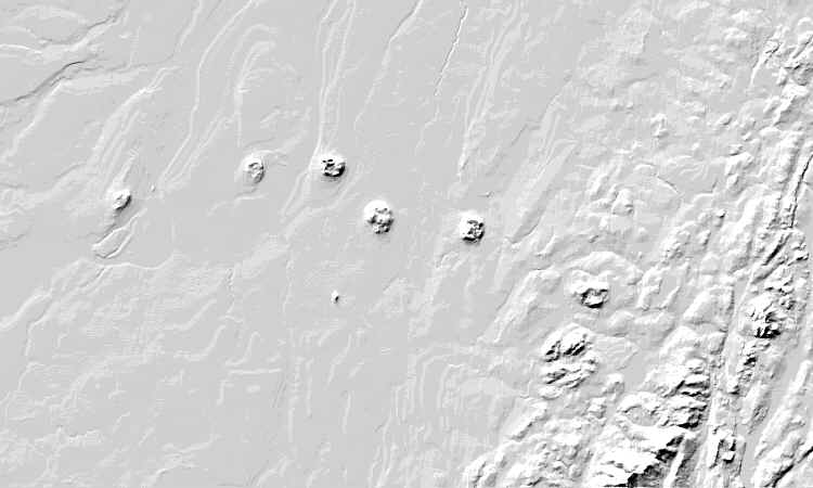
Use "Picture properties" to force "Gray scaled slope" mode.
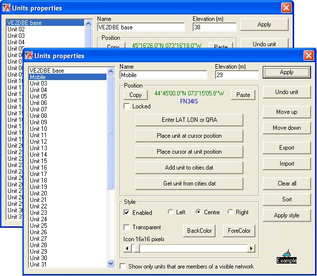
3. Position my QTH
Open "Unit properties" in the "Edit" menu and click on "Enter Latitude and Longitude". Fill as per the following:
Back to "Unit properties" insure that the unit is enabled and that a 38m elevation is shown before to apply, repeat for mobile:
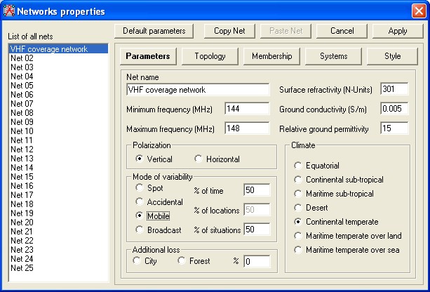
4. Enter Network data
Open "Networks properties" in the "Files" menu and fill as per the following:
Net parameters tab:
Net topology tab:

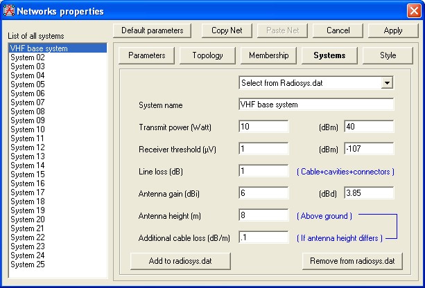
System tab for base:
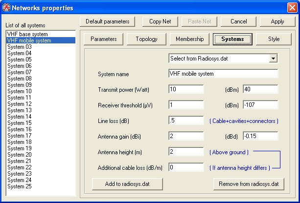
System tab for mobile:
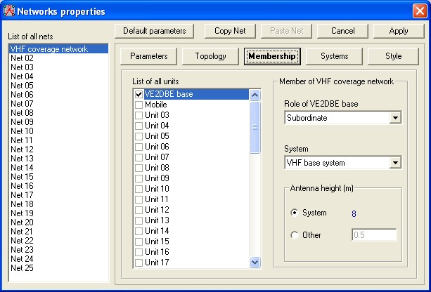
Net membership tab for base:
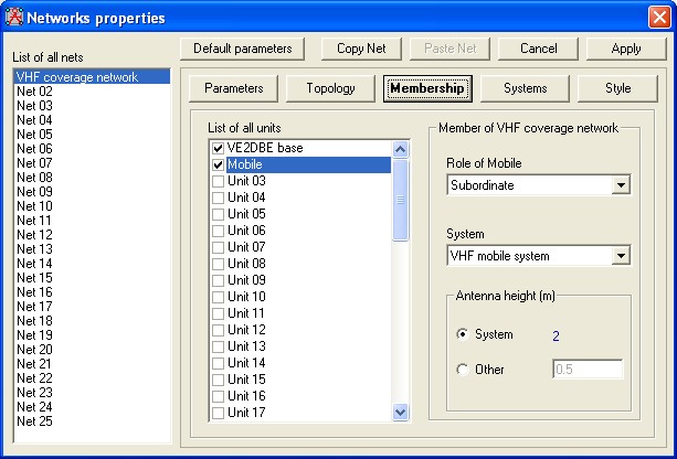
Net membership tab for mobile:
On apply, the program is ready for Radio Coverage!
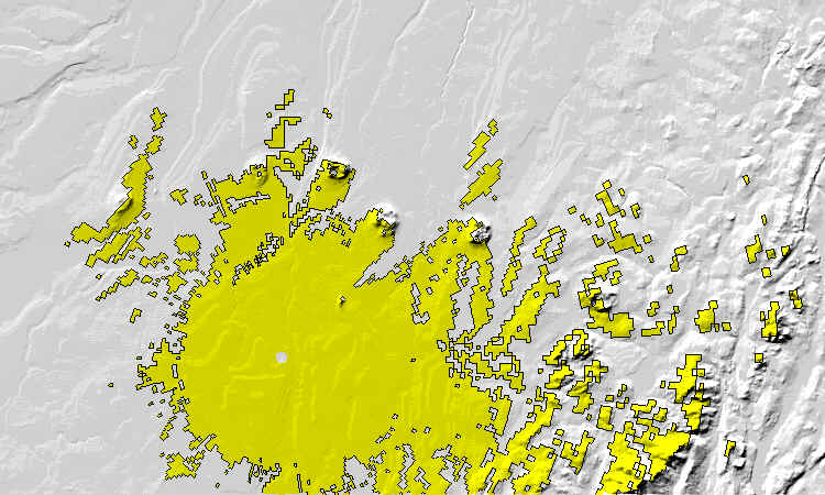
4. VHF Radio coverage!
In "View" menu, select "Radio coverage polar" and complete form as per the following:
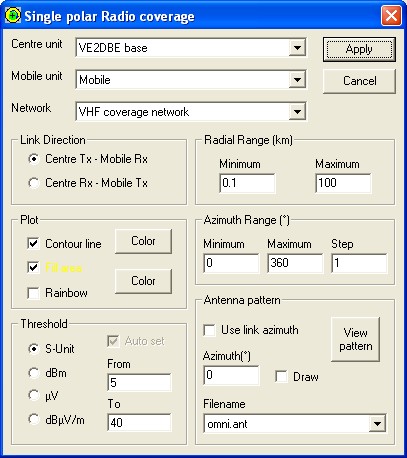
Click "Apply" button to obtain the resulting picture.